


If you’ve been researching land surveys for an upcoming building or development project, you’ve likely come across two terms used interchangeably: detail survey and feature survey. It’s a common source of confusion – and understandably so, because in most practical situations, they refer to the same thing.
But the terminology isn’t always consistent across Australia, and depending on which state you’re in, who you’re talking to, or what documentation you’re reading, the language can shift. Understanding the distinction – and why it sometimes isn’t one – will help you communicate clearly with your surveyor, architect, and council, and make sure you’re ordering exactly what your project needs.
Two Names, One Survey
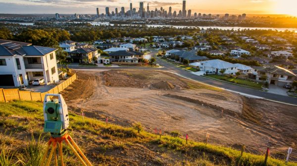
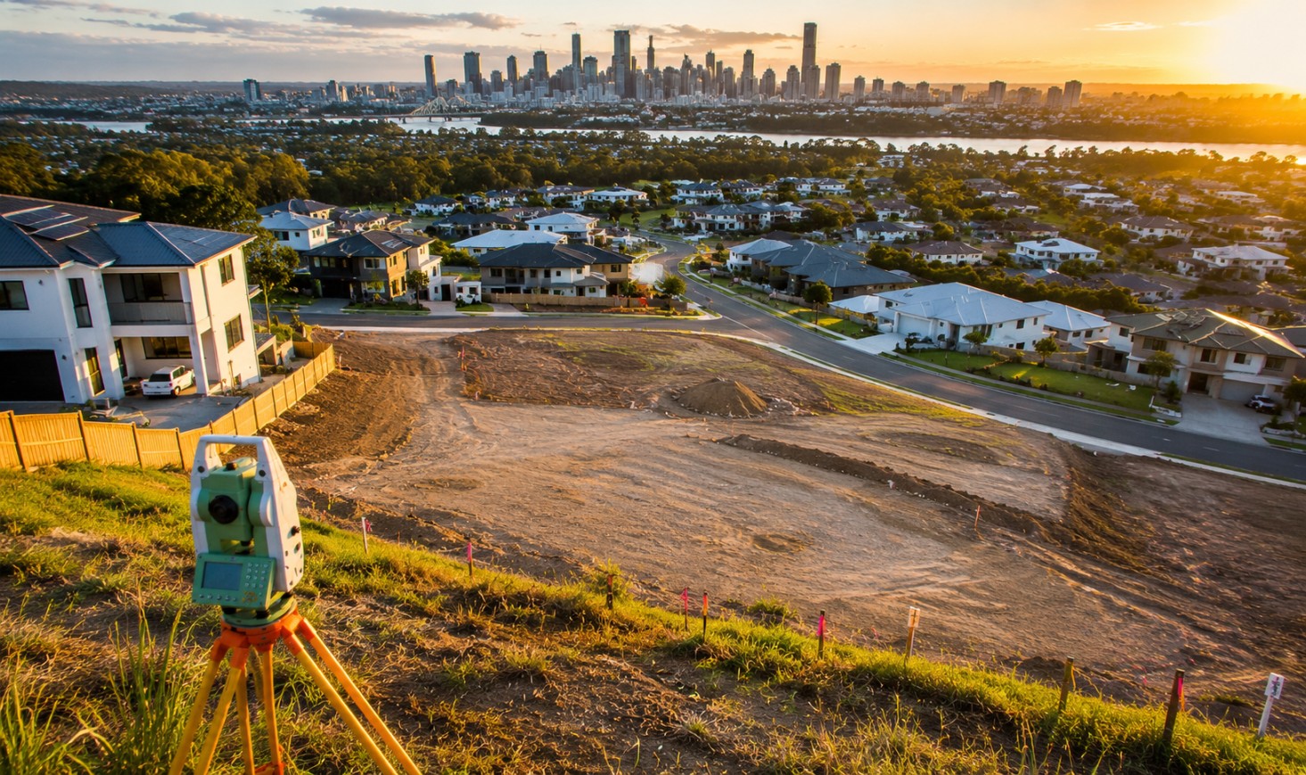
In the majority of cases, a feature survey and a detail survey are the same product. Both refer to a survey that captures the existing physical characteristics of a site – its structures, vegetation, boundaries, services, and levels – and presents them in a scaled plan that designers and engineers can work from.
The term feature and level survey is the most formally recognised name in Australian surveying practice and is the language used in most state-based guidelines and standards. However, detail survey (and contour and detail survey) are widely used in industry, particularly in Victoria, Queensland, and New South Wales, and are perfectly understood by any licensed surveyor across the country.
If you ask for a detail survey, you’ll get the same outcome as asking for a feature and level survey. What matters far more than the terminology is ensuring you – and your surveyor – are aligned on exactly what the survey needs to include.
What These Surveys Capture
Whether it’s called a feature survey or a detail survey, the core deliverable is the same. A licensed surveyor visits the site and records:
- Existing structures – the position, footprint, and relevant dimensions of any buildings, sheds, garages, or outbuildings
- Vegetation – trees are typically shown with their trunk location, species, height, and canopy spread, which is particularly important for heritage or significant tree overlays
- Boundaries and fences – including any discrepancies between the legal boundary and where a fence actually sits
- Levels and contours – the shape of the land across the site, referenced to the Australian Height Datum (AHD)
- Services – pits, covers, poles, meters, and other above-ground evidence of underground infrastructure
- Easements – legal encumbrances that affect what can be built on the land
- Neighbouring context – nearby structures, walls, or features that may affect the design
Where the Terminology Differs
The variation in language tends to follow state lines and professional context. In Victoria, feature survey or feature and level survey is the dominant term used by surveyors and referenced in planning documentation. In Queensland and New South Wales, detail survey and contour and detail survey are more common in day-to-day usage, particularly among builders, drafters, and project managers.
Some practitioners also use topographic survey to describe a similar product, though this term is more often applied to larger-scale or rural land assessments rather than standard residential or commercial development sites.
The takeaway: don’t get too caught up in the label. Instead, focus on briefing your surveyor clearly on what the survey is for, what scale it needs to be at, and what specific features must be captured.
Why the Distinction Matters in Practice
Where the terminology does matter is in council documentation and planning requirements. Some local councils specify the exact type of survey required when lodging a Development Application, and the wording in their requirements may use feature survey, detail survey, or feature and level survey depending on the state and council.
Before commissioning your survey, it’s worth checking your local council’s DA requirements to confirm the language they use and any specific deliverables they expect – such as minimum contour intervals, datum references, or inclusion of neighbouring structures.
Getting It Right From the Start
Whether you call it a feature survey or a detail survey, what you’re really asking for is an accurate, professional picture of your site – one that becomes the foundation for every design and construction decision that follows.
Engaging a licensed surveyor early, briefing them thoroughly, and confirming their output matches what your council and design team need will ensure the process runs smoothly from the very first step.
Michael Carry is the lead editor for Bonanza Magazine. Michael has been working as a freelance journalist for nearly a decade having published stories in the New York Times, The Plain Dealer, The Daily Mail and many others. Michael is based in Dawrin and covers issues affecting his city and global news. When he is not busy writing, Michael enjoys reading books and walking with his dogs.